
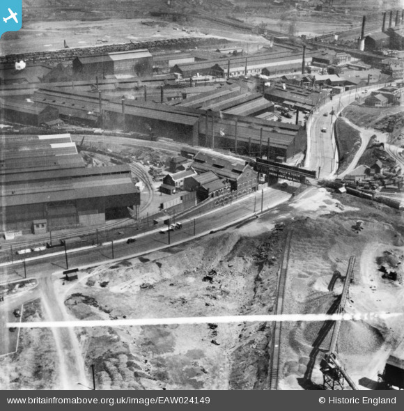
EAW024149 ENGLAND (1949). The Steel, Peech and Tozer Ickles Steel Works and Sheffield Road, Templeborough, from the east, 1949. This image has been produced from a print marked by Aerofilms Ltd for photo editing.
© Copyright OpenStreetMap contributors and licensed by the OpenStreetMap Foundation. 2026. Cartography is licensed as CC BY-SA.
Nearby Images (11)
EAW024149

EAW029396

EAW024148

EAW024150

EAW029395

EAW030489

EAW024147

EAW030487

EAW024152

EPW048730

EAW025971

Details
| Title | [EAW024149] The Steel, Peech and Tozer Ickles Steel Works and Sheffield Road, Templeborough, from the east, 1949. This image has been produced from a print marked by Aerofilms Ltd for photo editing. |
| Reference | EAW024149 |
| Date | 22-June-1949 |
| Link | |
| Place name | TEMPLEBOROUGH |
| Parish | |
| District | |
| Country | ENGLAND |
| Easting / Northing | 441582, 391551 |
| Longitude / Latitude | -1.3742579514842, 53.418860335912 |
| National Grid Reference | SK416916 |
Pins

Holmes Junction |
Thursday 22nd of January 2015 05:06:15 PM |