
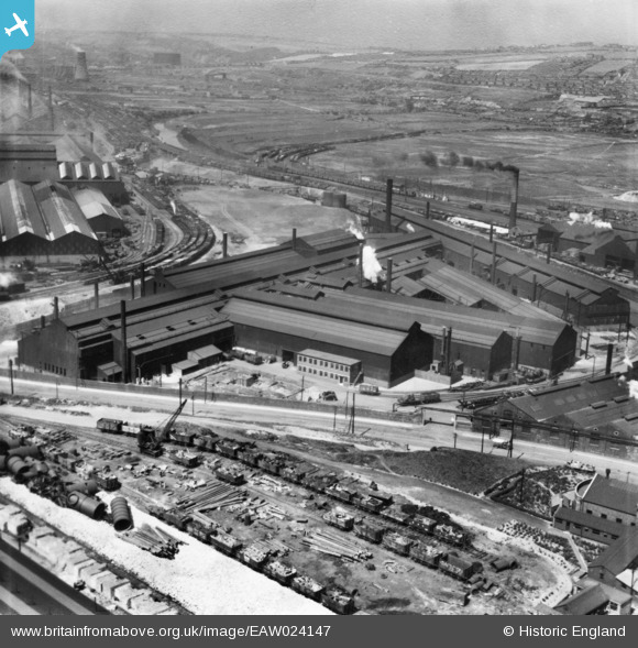
EAW024147 ENGLAND (1949). Part of the Steel, Peech and Tozer Ickles Steel Works, Templeborough, from the east, 1949. This image has been produced from a print.
© Copyright OpenStreetMap contributors and licensed by the OpenStreetMap Foundation. 2026. Cartography is licensed as CC BY-SA.
Nearby Images (19)
EAW024147

EAW030487

EPW015445

EAW025971

EAW025974

EAW030488

EAW025968

EAW030485

EAW024153

EAW029396

EAW024149

EPW015446

EPW041697

EAW024150

EAW025970

EAW024152

EAW024148

EAW030492

EPW041705

Details
| Title | [EAW024147] Part of the Steel, Peech and Tozer Ickles Steel Works, Templeborough, from the east, 1949. This image has been produced from a print. |
| Reference | EAW024147 |
| Date | 22-June-1949 |
| Link | |
| Place name | TEMPLEBOROUGH |
| Parish | |
| District | |
| Country | ENGLAND |
| Easting / Northing | 441734, 391687 |
| Longitude / Latitude | -1.3719527329223, 53.42007084068 |
| National Grid Reference | SK417917 |
Pins

Baggy |
Sunday 9th of October 2016 10:42:29 PM | |
|
Baggy |
Sunday 9th of October 2016 10:39:00 PM | |
|
Baggy |
Sunday 9th of October 2016 12:17:27 AM | |
|
Baggy |
Sunday 9th of October 2016 12:16:35 AM | |
|
MB |
Tuesday 4th of October 2016 09:37:56 AM | |
MandM |
Wednesday 12th of November 2014 07:26:37 PM | |
MandM |
Wednesday 12th of November 2014 07:26:16 PM |

