
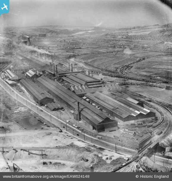
EAW024148 ENGLAND (1949). The Steel, Peech and Tozer Templeborough Steel Works, Templeborough, from the east, 1949. This image has been produced from a print.
© Copyright OpenStreetMap contributors and licensed by the OpenStreetMap Foundation. 2026. Cartography is licensed as CC BY-SA.
Nearby Images (10)
EAW024148

EAW024149

EAW024150

EAW029396

EAW029395

EAW030489

EAW029394

EAW024147

EAW030487

EPW048730

Details
| Title | [EAW024148] The Steel, Peech and Tozer Templeborough Steel Works, Templeborough, from the east, 1949. This image has been produced from a print. |
| Reference | EAW024148 |
| Date | 22-June-1949 |
| Link | |
| Place name | TEMPLEBOROUGH |
| Parish | |
| District | |
| Country | ENGLAND |
| Easting / Northing | 441533, 391530 |
| Longitude / Latitude | -1.3749980423963, 53.418675426593 |
| National Grid Reference | SK415915 |
Pins
Be the first to add a comment to this image!