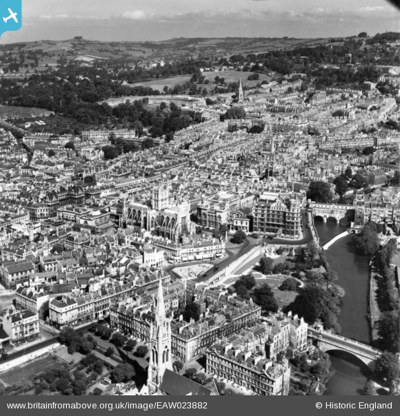
EAW023882 ENGLAND (1949). The Abbey Church of St Peter and St Paul and the city centre, Bath, from the south-east, 1949. This image has been produced from a print.
© Copyright OpenStreetMap contributors and licensed by the OpenStreetMap Foundation. 2026. Cartography is licensed as CC BY-SA.
Nearby Images (29)
EAW023882

EAW023884

EAW000755

EAW000757

EAW000756

EAW000754

EPW001957

EAW000746

EAW000759

EAW023885

EPW001945

EAW000748

EPW001942

EAW000758

EPW001161

EPW033153

EPW001950

EPW048403

EAW000760

EAW026450

EPW001953

EPW053141

EPW048402

EAW049901

EAW000747

EAW000749
 Bridge, Bath, 1946")
EAW049898

EAW000761

EAW049899

Details
| Title | [EAW023882] The Abbey Church of St Peter and St Paul and the city centre, Bath, from the south-east, 1949. This image has been produced from a print. |
| Reference | EAW023882 |
| Date | 14-June-1949 |
| Link | |
| Place name | BATH |
| Parish | |
| District | |
| Country | ENGLAND |
| Easting / Northing | 375252, 164693 |
| Longitude / Latitude | -2.3556374630371, 51.380249856816 |
| National Grid Reference | ST753647 |
Pins
Be the first to add a comment to this image!