
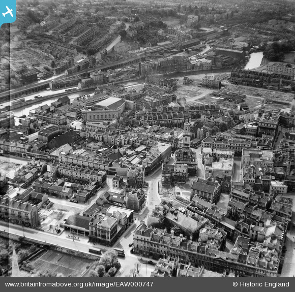
EAW000747 ENGLAND (1946). The area around the Church of St James and New Orchard Street, Bath, 1946
© Copyright OpenStreetMap contributors and licensed by the OpenStreetMap Foundation. 2026. Cartography is licensed as CC BY-SA.
Nearby Images (26)
EAW000747

EAW000749
 Bridge, Bath, 1946")
EPW033153

EPW001953

EPW001169

EPR000130

EAW023887

EAW000748

EPW001942

EAW026448

EAW000746

EAW000756

EAW000760

EAW000757

EAW023888

EAW000754

EPW001945

EAW000755

EAW023884

EPW001161

EAW023882

EAW000759

EAW023886

EPW033156

EAW026449

EPW001957

Details
| Title | [EAW000747] The area around the Church of St James and New Orchard Street, Bath, 1946 |
| Reference | EAW000747 |
| Date | 9-May-1946 |
| Link | |
| Place name | BATH |
| Parish | |
| District | |
| Country | ENGLAND |
| Easting / Northing | 375055, 164542 |
| Longitude / Latitude | -2.3584577565094, 51.378883361405 |
| National Grid Reference | ST751645 |
Pins

H Campbell |
Saturday 11th of January 2014 10:13:28 PM |