
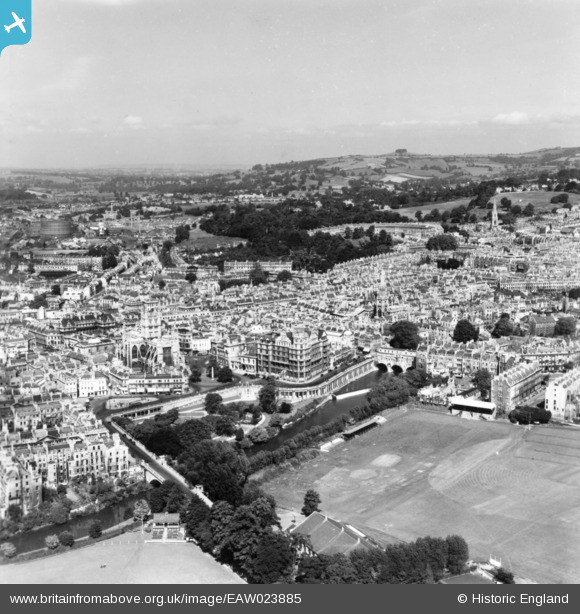
EAW023885 ENGLAND (1949). Parade Gardens and the city centre, Bath, 1949. This image has been produced from a print.
© Copyright OpenStreetMap contributors and licensed by the OpenStreetMap Foundation. 2026. Cartography is licensed as CC BY-SA.
Nearby Images (25)
EAW023885

EPW001957

EPW048403

EAW026450

EAW023882

EAW023884

EAW000755

EAW049901

EPW048402

EPW001950

EAW000754

EAW049898

EPW048380

EAW000757

EAW000756

EAW000759

EPW001945

EAW000758

EAW049899

EAW000746

EPW001161

EPW001942

EAW000748

EPW048377

EAW049900

Details
| Title | [EAW023885] Parade Gardens and the city centre, Bath, 1949. This image has been produced from a print. |
| Reference | EAW023885 |
| Date | 14-June-1949 |
| Link | |
| Place name | BATH |
| Parish | |
| District | |
| Country | ENGLAND |
| Easting / Northing | 375341, 164772 |
| Longitude / Latitude | -2.3543640138788, 51.38096414014 |
| National Grid Reference | ST753648 |
Pins
Be the first to add a comment to this image!