
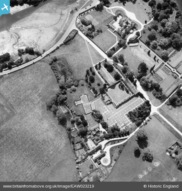
EAW023219 ENGLAND (1949). Beaulieu Abbey, Beaulieu, 1949
© Copyright OpenStreetMap contributors and licensed by the OpenStreetMap Foundation. 2025. Cartography is licensed as CC BY-SA.
Nearby Images (13)
EAW023219

EAW023216

EPW037451

EAW023220

EPW032279

EAW023218

EAW023217

EAW023215

EPW032277

EPW032278

EAW023214

EPW037449

EAW023213

Details
| Title | [EAW023219] Beaulieu Abbey, Beaulieu, 1949 |
| Reference | EAW023219 |
| Date | 19-May-1949 |
| Link | |
| Place name | BEAULIEU |
| Parish | BEAULIEU |
| District | |
| Country | ENGLAND |
| Easting / Northing | 438879, 102551 |
| Longitude / Latitude | -1.4479988688965, 50.820633314395 |
| National Grid Reference | SU389026 |
Pins
Be the first to add a comment to this image!