
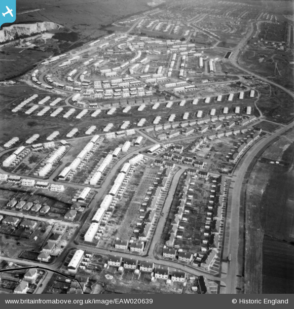
EAW020639 ENGLAND (1948). Paulsgrove Housing Estate, Paulsgrove, 1948. This image has been produced from a damaged negative.
© Copyright OpenStreetMap contributors and licensed by the OpenStreetMap Foundation. 2026. Cartography is licensed as CC BY-SA.
Nearby Images (8)
EAW020639

EAW020637

EAW020626

EAW020635

EAW020640

EAW020630

EAW020627

EAW020628

Details
| Title | [EAW020639] Paulsgrove Housing Estate, Paulsgrove, 1948. This image has been produced from a damaged negative. |
| Reference | EAW020639 |
| Date | 8-December-1948 |
| Link | |
| Place name | PAULSGROVE |
| Parish | |
| District | |
| Country | ENGLAND |
| Easting / Northing | 462957, 106119 |
| Longitude / Latitude | -1.10556407127, 50.85060047119 |
| National Grid Reference | SU630061 |
Pins
Be the first to add a comment to this image!