
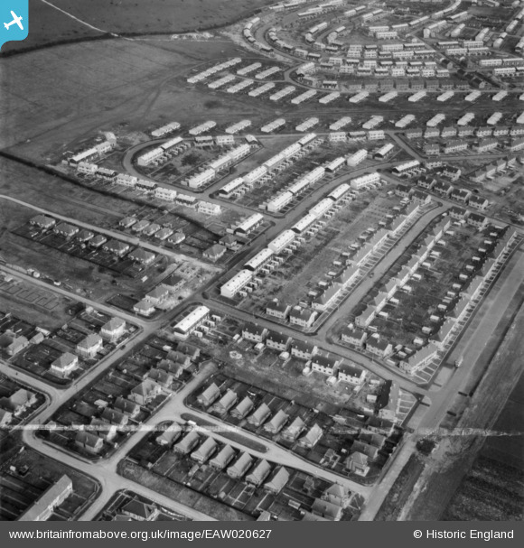
EAW020627 ENGLAND (1948). Housing surrounding Bude Close and Mousehole Road, Paulsgrove, 1948. This image was marked by Aerofilms Ltd for photo editing.
© Copyright OpenStreetMap contributors and licensed by the OpenStreetMap Foundation. 2026. Cartography is licensed as CC BY-SA.
Nearby Images (5)
EAW020627

EAW020630

EAW020637

EAW020639

EAW020640

Details
| Title | [EAW020627] Housing surrounding Bude Close and Mousehole Road, Paulsgrove, 1948. This image was marked by Aerofilms Ltd for photo editing. |
| Reference | EAW020627 |
| Date | 8-December-1948 |
| Link | |
| Place name | PAULSGROVE |
| Parish | |
| District | |
| Country | ENGLAND |
| Easting / Northing | 462728, 106131 |
| Longitude / Latitude | -1.1088150179415, 50.850733266856 |
| National Grid Reference | SU627061 |
Pins
Be the first to add a comment to this image!