
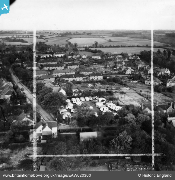
EAW020300 ENGLAND (1948). Caravans at the junction of Plantation Road and New Road, Amersham, from the south-west, 1948. This image has been produced from a print marked by Aerofilms Ltd for photo editing.
© Copyright OpenStreetMap contributors and licensed by the OpenStreetMap Foundation. 2026. Cartography is licensed as CC BY-SA.
Nearby Images (21)
EAW020300

EAW018522

EAW020303

EAW019448

EAW019445

EAW020305

EAW020301

EAW019446

EAW019447

EAW019449

EAW020299

EAW020302

EAW018520

EAW018524

EAW020297

EAW020298

EAW020304

EAW018523

EAW018521

EAW018526

EAW018525

Details
| Title | [EAW020300] Caravans at the junction of Plantation Road and New Road, Amersham, from the south-west, 1948. This image has been produced from a print marked by Aerofilms Ltd for photo editing. |
| Reference | EAW020300 |
| Date | 3-November-1948 |
| Link | |
| Place name | AMERSHAM |
| Parish | AMERSHAM |
| District | |
| Country | ENGLAND |
| Easting / Northing | 497315, 198603 |
| Longitude / Latitude | -0.59238863200036, 51.677289833444 |
| National Grid Reference | SU973986 |
Pins

Billy Turner |
Friday 28th of October 2016 08:15:30 PM | |

bondi |
Friday 19th of December 2014 11:07:26 PM | |
|
bondi |
Friday 19th of December 2014 11:07:23 PM |
