
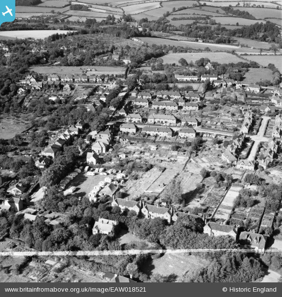
EAW018521 ENGLAND (1948). Residential area around New Road and Plantation Way, Amersham, 1948. This image was marked by Aerofilms Ltd for photo editing.
© Copyright OpenStreetMap contributors and licensed by the OpenStreetMap Foundation. 2026. Cartography is licensed as CC BY-SA.
Nearby Images (21)
EAW018521

EAW020298

EAW020297

EAW018523

EAW020304

EAW018525

EAW018520

EAW020302

EAW019449

EAW019447

EAW019446

EAW020305

EAW019448

EAW019445

EAW020301

EAW018526

EAW018522

EAW020299

EAW020300

EAW020303

EAW018524

Details
| Title | [EAW018521] Residential area around New Road and Plantation Way, Amersham, 1948. This image was marked by Aerofilms Ltd for photo editing. |
| Reference | EAW018521 |
| Date | 9-September-1948 |
| Link | |
| Place name | AMERSHAM |
| Parish | AMERSHAM |
| District | |
| Country | ENGLAND |
| Easting / Northing | 497388, 198722 |
| Longitude / Latitude | -0.59129987087777, 51.678346930062 |
| National Grid Reference | SU974987 |
Pins
Be the first to add a comment to this image!