
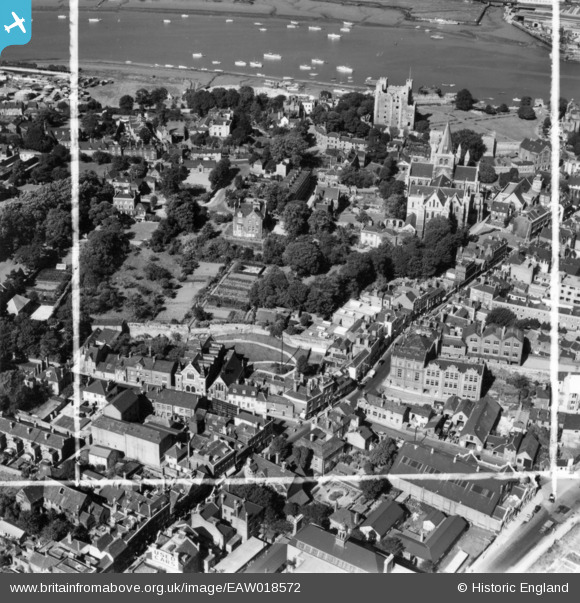
EAW018572 ENGLAND (1948). The High Street, Cathedral and Castle, Rochester, 1948. This image has been produced from a print marked by Aerofilms Ltd for photo editing.
© Copyright OpenStreetMap contributors and licensed by the OpenStreetMap Foundation. 2026. Cartography is licensed as CC BY-SA.
Nearby Images (24)
EAW018572

EAW018577

EAW018575

EAW018573

EAW003542

EAW018578

EAW018579

EAW018574

EAW018576

EAW004796

EAW004793

EAW003541

EAW003540

EAW004791

EAW017033

EAW004795

EAW017035

EAW003539

EAW004845

EAW003543

EAW004792

EAW004794

EAW017034

EAW017032
, town and the River Medway, Rochester, 1948. This image has been produced from a damaged negative.")
Details
| Title | [EAW018572] The High Street, Cathedral and Castle, Rochester, 1948. This image has been produced from a print marked by Aerofilms Ltd for photo editing. |
| Reference | EAW018572 |
| Date | 9-September-1948 |
| Link | |
| Place name | ROCHESTER |
| Parish | |
| District | |
| Country | ENGLAND |
| Easting / Northing | 574327, 168407 |
| Longitude / Latitude | 0.5057029537955, 51.387395496536 |
| National Grid Reference | TQ743684 |
Pins

medway |
Wednesday 19th of November 2014 11:28:27 PM |