
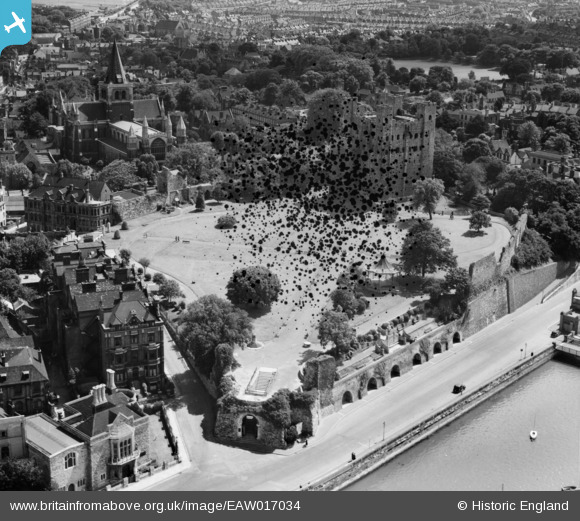
EAW017034 ENGLAND (1948). Rochester Castle, Rochester, 1948. This image has been produced from a damaged negative.
© Copyright OpenStreetMap contributors and licensed by the OpenStreetMap Foundation. 2026. Cartography is licensed as CC BY-SA.
Nearby Images (25)
EAW017034

EAW004794

EAW017032
, town and the River Medway, Rochester, 1948. This image has been produced from a damaged negative.")
EAW004792

EAW017033

EAW004791

EAW003543

EAW017035

EAW004845

EAW004795

EAW017036

EAW003540

EAW017031

EAW003539

EAW004793

EAW004796

EAW003541

EAW018579

EAW003542

EAW013913

EAW018573

EPW001443

EAW018575

EAW018572

EAW018577

Details
| Title | [EAW017034] Rochester Castle, Rochester, 1948. This image has been produced from a damaged negative. |
| Reference | EAW017034 |
| Date | 6-July-1948 |
| Link | |
| Place name | ROCHESTER |
| Parish | |
| District | |
| Country | ENGLAND |
| Easting / Northing | 574144, 168624 |
| Longitude / Latitude | 0.50318172475529, 51.389401232214 |
| National Grid Reference | TQ741686 |
Pins

Dylan Moore |
Tuesday 15th of July 2014 03:03:35 AM |