
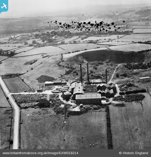
EAW018214 ENGLAND (1948). The Cumberworth Brick & Tile Co Ltd Works on Coal Pit Lane, Lower Cumberworth, from the north-west, 1948. This image has been produced from a damaged negative.
© Copyright OpenStreetMap contributors and licensed by the OpenStreetMap Foundation. 2026. Cartography is licensed as CC BY-SA.
Nearby Images (8)
EAW018214

EAW018215

EAW018218

EAW018217

EAW018213

EAW018216

EAW018211

EAW018212

Details
| Title | [EAW018214] The Cumberworth Brick & Tile Co Ltd Works on Coal Pit Lane, Lower Cumberworth, from the north-west, 1948. This image has been produced from a damaged negative. |
| Reference | EAW018214 |
| Date | 18-August-1948 |
| Link | |
| Place name | LOWER CUMBERWORTH |
| Parish | DENBY DALE |
| District | |
| Country | ENGLAND |
| Easting / Northing | 421806, 409803 |
| Longitude / Latitude | -1.6705775917875, 53.584121589646 |
| National Grid Reference | SE218098 |
Pins
Be the first to add a comment to this image!