
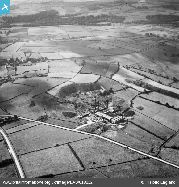
EAW018212 ENGLAND (1948). The Cumberworth Brick & Tile Co Ltd Works on Coal Pit Lane, Lower Cumberworth, 1948
© Copyright OpenStreetMap contributors and licensed by the OpenStreetMap Foundation. 2026. Cartography is licensed as CC BY-SA.
Nearby Images (7)
EAW018212

EAW018216

EAW018211

EAW018213

EAW018218

EAW018215

EAW018214

Details
| Title | [EAW018212] The Cumberworth Brick & Tile Co Ltd Works on Coal Pit Lane, Lower Cumberworth, 1948 |
| Reference | EAW018212 |
| Date | 18-August-1948 |
| Link | |
| Place name | LOWER CUMBERWORTH |
| Parish | DENBY DALE |
| District | |
| Country | ENGLAND |
| Easting / Northing | 421870, 409590 |
| Longitude / Latitude | -1.6696256946257, 53.582204227106 |
| National Grid Reference | SE219096 |
Pins

Vauni |
Tuesday 30th of August 2016 04:12:45 PM |