
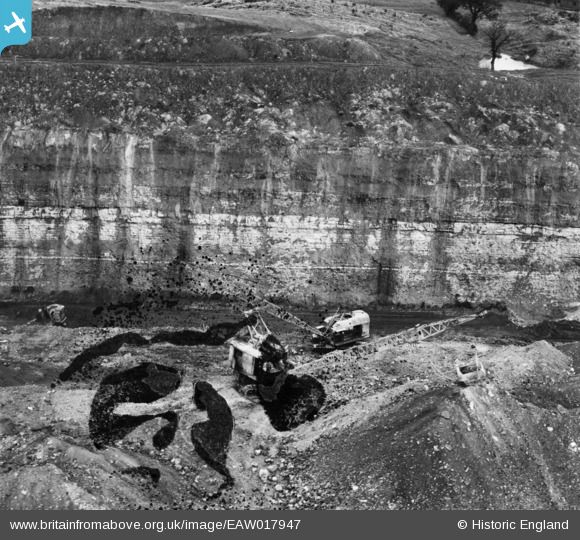
EAW017947 ENGLAND (1948). Opencast coal mining to the north of Carrington's Farm, Smalley, 1948. This image has been produced from a damaged negative.
© Copyright OpenStreetMap contributors and licensed by the OpenStreetMap Foundation. 2026. Cartography is licensed as CC BY-SA.
Nearby Images (13)
EAW017947

EAW017957

EAW017988

EAW017952

EAW017984

EAW017989

EAW017990

EAW017959

EAW017987

EAW011251

EAW011228

EAW011221

EAW011229

Details
| Title | [EAW017947] Opencast coal mining to the north of Carrington's Farm, Smalley, 1948. This image has been produced from a damaged negative. |
| Reference | EAW017947 |
| Date | 10-August-1948 |
| Link | |
| Place name | SMALLEY |
| Parish | SMALLEY |
| District | |
| Country | ENGLAND |
| Easting / Northing | 441395, 346101 |
| Longitude / Latitude | -1.3829706350416, 53.010308361236 |
| National Grid Reference | SK414461 |
Pins
Be the first to add a comment to this image!
User Comment Contributions
The pond and trees at the right background can also be seen in more detail on EAW011251 |

Class31 |
Saturday 4th of January 2014 08:59:11 PM |