
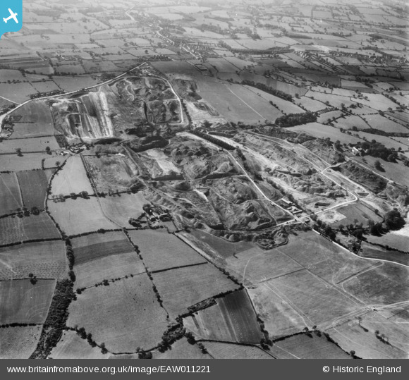
EAW011221 ENGLAND (1947). Opencast coal mining to the east of Flamstead House, Smalley, 1947
© Copyright OpenStreetMap contributors and licensed by the OpenStreetMap Foundation. 2026. Cartography is licensed as CC BY-SA.
Nearby Images (13)
EAW011221

EAW011229

EAW011228

EAW017990

EAW017989

EAW017952

EAW017988

EAW017947

EAW017957

EAW017984

EAW017987

EAW017959

EAW011251

Details
| Title | [EAW011221] Opencast coal mining to the east of Flamstead House, Smalley, 1947 |
| Reference | EAW011221 |
| Date | 30-September-1947 |
| Link | |
| Place name | SMALLEY |
| Parish | SMALLEY |
| District | |
| Country | ENGLAND |
| Easting / Northing | 441234, 346210 |
| Longitude / Latitude | -1.3853564108935, 53.011300662753 |
| National Grid Reference | SK412462 |
Pins


User Comment Contributions
View looking south |

Class31 |
Thursday 9th of January 2014 01:41:01 PM |