
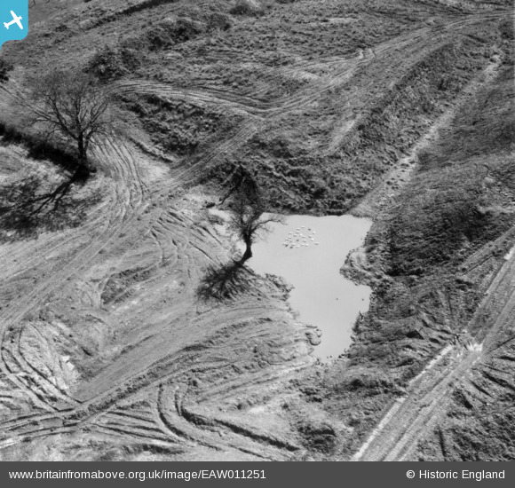
EAW011251 ENGLAND (1947). Disturbed land adjacent to an extensive area of opencast coal mining to the west of Kidsleypark Farm, Smalley, 1947
© Copyright OpenStreetMap contributors and licensed by the OpenStreetMap Foundation. 2026. Cartography is licensed as CC BY-SA.
Nearby Images (36)
EAW011251

EAW017959

EAW017987

EAW017984

EAW017957

EAW017947

EAW012048

EAW017988

EAW017952

EAW011244

EAW018409

EAW011897

EAW017989

EAW018410

EAW017990

EAW011898

EAW011896

EAW018397

EAW018414

EAW018398

EAW011899

EAW011895

EAW011900

EAW018399

EAW011892

EAW011890

EAW011894

EAW011893

EAW012047

EAW011889

EAW011891

EAW017951

EAW012044

EAW011228

EAW011252

EAW011221

Details
| Title | [EAW011251] Disturbed land adjacent to an extensive area of opencast coal mining to the west of Kidsleypark Farm, Smalley, 1947 |
| Reference | EAW011251 |
| Date | 30-September-1947 |
| Link | |
| Place name | SMALLEY |
| Parish | SMALLEY |
| District | |
| Country | ENGLAND |
| Easting / Northing | 441424, 345977 |
| Longitude / Latitude | -1.3825543008501, 53.009191397513 |
| National Grid Reference | SK414460 |
Pins
Be the first to add a comment to this image!
User Comment Contributions
The pond and trees can be seen in the background of EAW017947 |

Class31 |
Saturday 4th of January 2014 08:57:10 PM |