
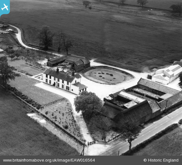
EAW016564 ENGLAND (1948). Manor Farm, Blofield, 1948. This image has been produced from a print.
© Copyright OpenStreetMap contributors and licensed by the OpenStreetMap Foundation. 2026. Cartography is licensed as CC BY-SA.
Nearby Images (15)
EAW016564

EAW016558

EAW016557

EAW016567

EAW016561

EAW016556

EAW016555

EAW016568

EAW016566

EAW016565

EAW016559

EAW016562

EAW016560

EAW016563

EAW016569

Details
| Title | [EAW016564] Manor Farm, Blofield, 1948. This image has been produced from a print. |
| Reference | EAW016564 |
| Date | 14-June-1948 |
| Link | |
| Place name | BLOFIELD |
| Parish | BLOFIELD |
| District | |
| Country | ENGLAND |
| Easting / Northing | 632892, 309460 |
| Longitude / Latitude | 1.4420099154206, 52.632478122096 |
| National Grid Reference | TG329095 |
Pins
Be the first to add a comment to this image!