
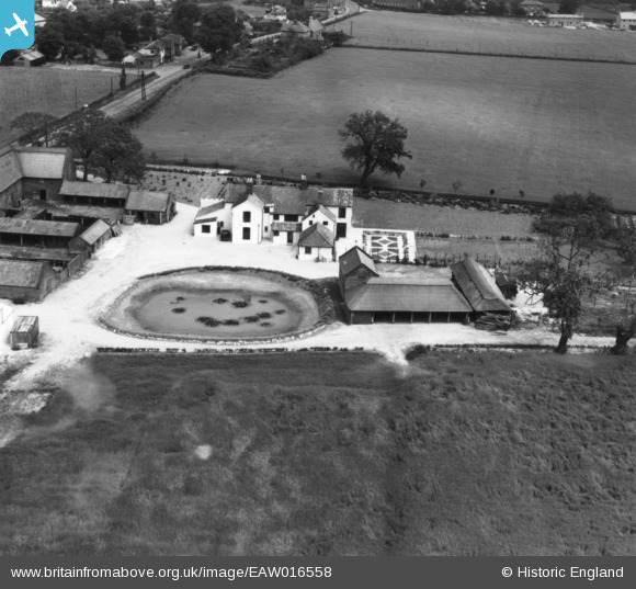
EAW016558 ENGLAND (1948). Manor Farm, Blofield, 1948. This image has been produced from a print.
© Copyright OpenStreetMap contributors and licensed by the OpenStreetMap Foundation. 2026. Cartography is licensed as CC BY-SA.
Nearby Images (15)
EAW016558

EAW016564

EAW016557

EAW016561

EAW016567

EAW016555

EAW016556

EAW016568

EAW016566

EAW016565

EAW016559

EAW016562

EAW016560

EAW016563

EAW016569

Details
| Title | [EAW016558] Manor Farm, Blofield, 1948. This image has been produced from a print. |
| Reference | EAW016558 |
| Date | 14-June-1948 |
| Link | |
| Place name | BLOFIELD |
| Parish | BLOFIELD |
| District | |
| Country | ENGLAND |
| Easting / Northing | 632893, 309450 |
| Longitude / Latitude | 1.4420176147764, 52.63238794767 |
| National Grid Reference | TG329095 |
Pins

East Anglian |
Tuesday 9th of February 2021 04:17:48 PM | |
|
East Anglian |
Tuesday 9th of February 2021 02:56:35 PM |