
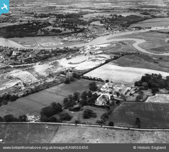
EAW016450 ENGLAND (1948). Gravel pits to the north of East Donyland Hall, Rowhedge, 1948. This image has been produced from a print.
© Copyright OpenStreetMap contributors and licensed by the OpenStreetMap Foundation. 2026. Cartography is licensed as CC BY-SA.
Nearby Images (11)
EAW016450

EAW016447

EAW037429

EAW016448

EAW015337

EAW037428

EAW016446

EAW015338

EAW037425

EAW015339

EAW037426

Details
| Title | [EAW016450] Gravel pits to the north of East Donyland Hall, Rowhedge, 1948. This image has been produced from a print. |
| Reference | EAW016450 |
| Date | 9-June-1948 |
| Link | |
| Place name | ROWHEDGE |
| Parish | EAST DONYLAND |
| District | |
| Country | ENGLAND |
| Easting / Northing | 602900, 221119 |
| Longitude / Latitude | 0.94638660261219, 51.851283563299 |
| National Grid Reference | TM029211 |
Pins
Be the first to add a comment to this image!