
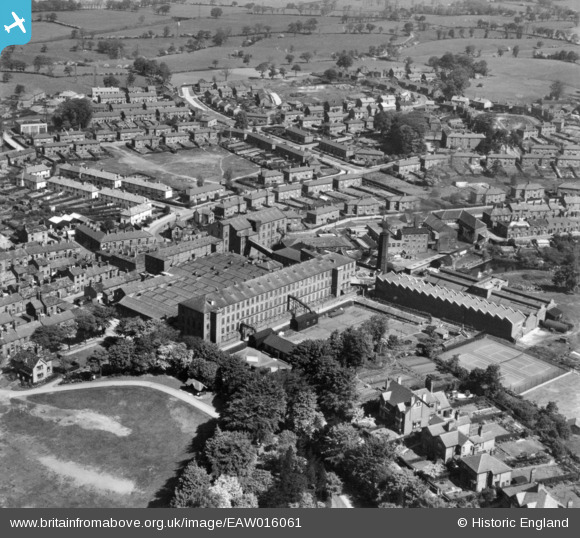
EAW016061 ENGLAND (1948). The Brocklehurst-Whiston Amalgamated Ltd Silk Mill and surrounding residential area, Hurdsfield, 1948. This image has been produced from a print.
© Copyright OpenStreetMap contributors and licensed by the OpenStreetMap Foundation. 2026. Cartography is licensed as CC BY-SA.
Nearby Images (14)
EAW016061

EPW050705

EPW050703

EPW050701

EPW050700

EAW016060

EAW016056

EAW016057

EPW016744

EAW016058

EAW016055

EPW050704

EPW050702

EAW016059

Details
| Title | [EAW016061] The Brocklehurst-Whiston Amalgamated Ltd Silk Mill and surrounding residential area, Hurdsfield, 1948. This image has been produced from a print. |
| Reference | EAW016061 |
| Date | 21-May-1948 |
| Link | |
| Place name | HURDSFIELD |
| Parish | |
| District | |
| Country | ENGLAND |
| Easting / Northing | 392290, 374056 |
| Longitude / Latitude | -2.1156006015305, 53.263168642018 |
| National Grid Reference | SJ923741 |
Pins

goral |
Sunday 30th of September 2018 01:02:06 AM |