
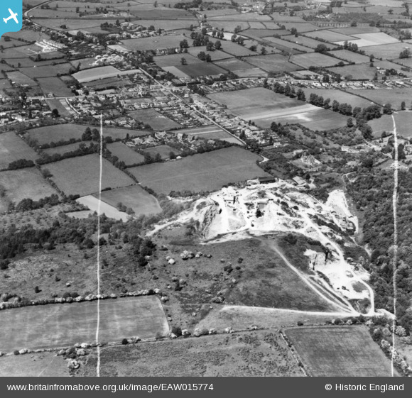
EAW015774 ENGLAND (1948). Coles Stone Quarry and the village, Backwell, 1948. This image has been produced from a print marked by Aerofilms Ltd for photo editing.
© Copyright OpenStreetMap contributors and licensed by the OpenStreetMap Foundation. 2026. Cartography is licensed as CC BY-SA.
Nearby Images (18)
EAW015774

EAW015778

EAW023897

EAW023893

EAW023890

EAW023896

EAW023895

EPW058931

EPW058930

EPW058929

EPW058933

EPW058935

EAW023898

EPW058932

EAW015775

EAW023894

EPW058934

EAW015777

Details
| Title | [EAW015774] Coles Stone Quarry and the village, Backwell, 1948. This image has been produced from a print marked by Aerofilms Ltd for photo editing. |
| Reference | EAW015774 |
| Date | 18-May-1948 |
| Link | |
| Place name | BACKWELL |
| Parish | BACKWELL |
| District | |
| Country | ENGLAND |
| Easting / Northing | 348956, 168016 |
| Longitude / Latitude | -2.7339735319923, 51.408374073845 |
| National Grid Reference | ST490680 |
Pins
Be the first to add a comment to this image!