
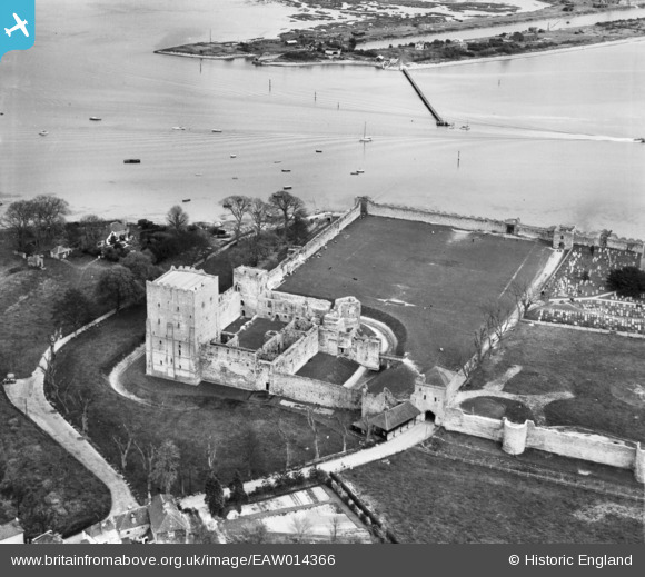
EAW014366 ENGLAND (1948). Portchester Castle, Portchester, 1948
© Copyright OpenStreetMap contributors and licensed by the OpenStreetMap Foundation. 2025. Cartography is licensed as CC BY-SA.
Nearby Images (10)
EAW014366

EAW005094

EAW014367

EAW005095

EAW005096

EAW005098

EAW014364

EAW005097

EAW014365

EAW014368

Details
| Title | [EAW014366] Portchester Castle, Portchester, 1948 |
| Reference | EAW014366 |
| Date | 13-April-1948 |
| Link | |
| Place name | PORTCHESTER |
| Parish | |
| District | |
| Country | ENGLAND |
| Easting / Northing | 462498, 104623 |
| Longitude / Latitude | -1.1123396058141, 50.837197576277 |
| National Grid Reference | SU625046 |


