
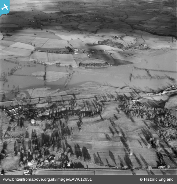
EAW012651 ENGLAND (1948). The River Severn in flood, Cound, 1948
© Copyright OpenStreetMap contributors and licensed by the OpenStreetMap Foundation. 2026. Cartography is licensed as CC BY-SA.
Nearby Images (5)
EAW012651

EAW012650

EAW012556

EAW012555

EPW051439

Details
| Title | [EAW012651] The River Severn in flood, Cound, 1948 |
| Reference | EAW012651 |
| Date | 14-January-1948 |
| Link | |
| Place name | COUND |
| Parish | COUND |
| District | |
| Country | ENGLAND |
| Easting / Northing | 356662, 305504 |
| Longitude / Latitude | -2.6405986253996, 52.645191131259 |
| National Grid Reference | SJ567055 |
Pins
Be the first to add a comment to this image!