
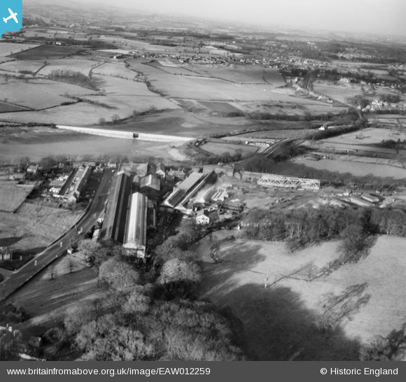
EAW012259 ENGLAND (1947). The Butterley Iron Works and environs, Butterley, from the south, 1947
© Copyright OpenStreetMap contributors and licensed by the OpenStreetMap Foundation. 2026. Cartography is licensed as CC BY-SA.
Nearby Images (23)
EAW012259

EPW050255

EPW050253

EPW050252

EPW050251

EPW050254

EAW012242

EAW012243

EAW012251

EAW012263

EAW012257

EAW012258

EAW012264

EAW012247

EAW012260

EAW012244

EAW012246

EAW012245

EAW012249

EAW012250

EAW012254

EAW012256

EAW012262

Details
| Title | [EAW012259] The Butterley Iron Works and environs, Butterley, from the south, 1947 |
| Reference | EAW012259 |
| Date | 24-November-1947 |
| Link | |
| Place name | BUTTERLEY |
| Parish | RIPLEY |
| District | |
| Country | ENGLAND |
| Easting / Northing | 440175, 351476 |
| Longitude / Latitude | -1.4004849122891, 53.058720807528 |
| National Grid Reference | SK402515 |
Pins

John W |
Tuesday 31st of January 2017 04:10:08 PM | |
|
Maitland |
Thursday 12th of March 2015 06:52:49 AM | |
|
gellert |
Thursday 20th of February 2014 06:38:41 PM |