
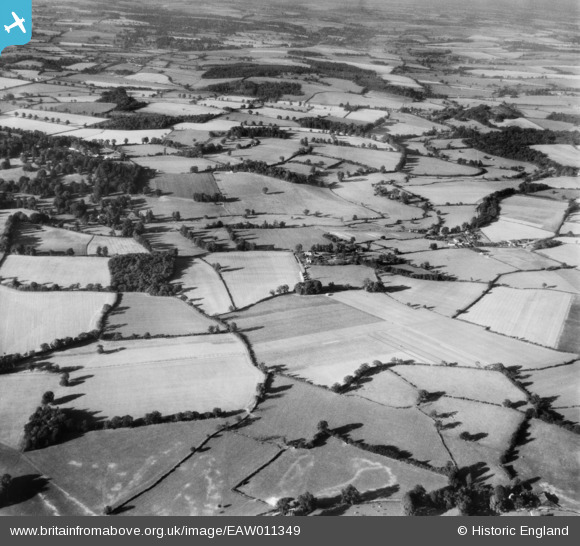
EAW011349 ENGLAND (1947). Swangles Farm and the surrounding countryside, Cold Christmas, 1947
© Copyright OpenStreetMap contributors and licensed by the OpenStreetMap Foundation. 2026. Cartography is licensed as CC BY-SA.
Nearby Images (15)
EAW011349

EAW011945

EAW011943

EAW011946

EAW011354

EAW011353

EAW011356

EAW011948

EAW011350

EAW011947

EAW011949

EAW011944

EAW011352

EAW011355

EAW011351

Details
| Title | [EAW011349] Swangles Farm and the surrounding countryside, Cold Christmas, 1947 |
| Reference | EAW011349 |
| Date | 1-October-1947 |
| Link | |
| Place name | COLD CHRISTMAS |
| Parish | THUNDRIDGE |
| District | |
| Country | ENGLAND |
| Easting / Northing | 537621, 216937 |
| Longitude / Latitude | -0.0024487695924058, 51.833621586284 |
| National Grid Reference | TL376169 |
Pins
Be the first to add a comment to this image!