
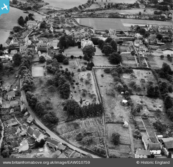
EAW010759 ENGLAND (1947). Gardens and allotments behind Bratton House, Bratton, 1947
© Copyright OpenStreetMap contributors and licensed by the OpenStreetMap Foundation. 2025. Cartography is licensed as CC BY-SA.
Nearby Images (9)
EAW010759

EAW010762

EAW010757

EAW010758

EAW010763

EAW010755

EAW010756

EAW010761

EAW010760

Details
| Title | [EAW010759] Gardens and allotments behind Bratton House, Bratton, 1947 |
| Reference | EAW010759 |
| Date | 17-September-1947 |
| Link | |
| Place name | BRATTON |
| Parish | BRATTON |
| District | |
| Country | ENGLAND |
| Easting / Northing | 391611, 152616 |
| Longitude / Latitude | -2.1202695658461, 51.272122002018 |
| National Grid Reference | ST916526 |
Pins

Class31 |
Monday 13th of January 2014 09:22:45 AM | |
|
Class31 |
Monday 13th of January 2014 09:20:09 AM | |
|
Class31 |
Monday 13th of January 2014 09:16:39 AM | |
|
Class31 |
Monday 13th of January 2014 09:14:27 AM | |
|
Class31 |
Monday 13th of January 2014 09:12:21 AM | |
|
Class31 |
Monday 13th of January 2014 09:08:26 AM | |
|
Class31 |
Monday 13th of January 2014 09:06:17 AM | |
|
Class31 |
Monday 13th of January 2014 09:04:29 AM |


User Comment Contributions
View looking south |
Class31 |
Monday 13th of January 2014 09:03:05 AM |