
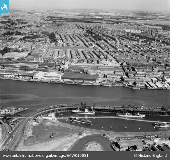
EAW010681 ENGLAND (1947). Dunston Staiths, the Vickers-Armstrongs Ltd Elswick Works and environs, Dunston, from the south, 1947. This image was marked by Aerofilms Ltd for photo editing.
© Copyright OpenStreetMap contributors and licensed by the OpenStreetMap Foundation. 2026. Cartography is licensed as CC BY-SA.
Nearby Images (5)
EAW010681

EAW010706

EAW010690

EAW010691

EAW010689

Details
| Title | [EAW010681] Dunston Staiths, the Vickers-Armstrongs Ltd Elswick Works and environs, Dunston, from the south, 1947. This image was marked by Aerofilms Ltd for photo editing. |
| Reference | EAW010681 |
| Date | 10-September-1947 |
| Link | |
| Place name | DUNSTON |
| Parish | |
| District | |
| Country | ENGLAND |
| Easting / Northing | 423491, 562689 |
| Longitude / Latitude | -1.6331174416604, 54.958207565398 |
| National Grid Reference | NZ235627 |
Pins

redmist |
Monday 19th of October 2020 09:50:20 AM |