
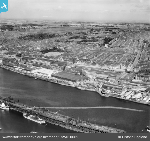
EAW010689 ENGLAND (1947). The Vickers-Armstrongs Ltd Elswick Works and environs, Elswick, from the south, 1947. This image was marked by Aerofilms Ltd for photo editing.
© Copyright OpenStreetMap contributors and licensed by the OpenStreetMap Foundation. 2026. Cartography is licensed as CC BY-SA.
Nearby Images (11)
EAW010689

EAW010691

EAW010692

EAW010701

EAW010690

EAW010682

EAW010680

EAW010700

EAW010708

EAW010681

EAW010699

Details
| Title | [EAW010689] The Vickers-Armstrongs Ltd Elswick Works and environs, Elswick, from the south, 1947. This image was marked by Aerofilms Ltd for photo editing. |
| Reference | EAW010689 |
| Date | 10-September-1947 |
| Link | |
| Place name | ELSWICK |
| Parish | |
| District | |
| Country | ENGLAND |
| Easting / Northing | 423260, 562864 |
| Longitude / Latitude | -1.6367109311642, 54.959791138134 |
| National Grid Reference | NZ233629 |
