
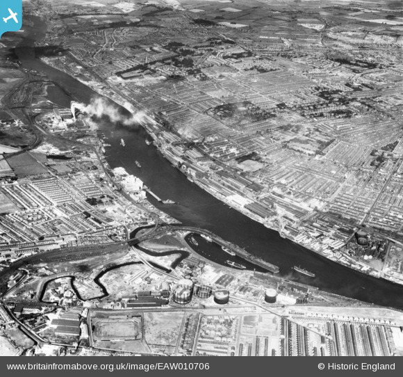
EAW010706 ENGLAND (1947). Dunston Staiths, the River Tyne, the Vickers-Armstrongs Ltd Elswick Works and environs, Dunston, from the south-east, 1947
© Copyright OpenStreetMap contributors and licensed by the OpenStreetMap Foundation. 2026. Cartography is licensed as CC BY-SA.
Nearby Images (2)
EAW010706

EAW010681

Details
| Title | [EAW010706] Dunston Staiths, the River Tyne, the Vickers-Armstrongs Ltd Elswick Works and environs, Dunston, from the south-east, 1947 |
| Reference | EAW010706 |
| Date | 10-September-1947 |
| Link | |
| Place name | DUNSTON |
| Parish | |
| District | |
| Country | ENGLAND |
| Easting / Northing | 423546, 562561 |
| Longitude / Latitude | -1.6322689756444, 54.957054622578 |
| National Grid Reference | NZ235626 |
Pins

redmist |
Tuesday 20th of October 2020 10:24:42 AM | |
|
redmist |
Tuesday 20th of October 2020 10:24:18 AM | |
|
redmist |
Tuesday 20th of October 2020 10:23:19 AM | |
|
redmist |
Tuesday 20th of October 2020 10:22:34 AM | |
|
redmist |
Saturday 16th of November 2019 11:05:43 PM | |
|
redmist |
Saturday 16th of November 2019 10:52:06 PM | |
|
redmist |
Saturday 16th of November 2019 10:51:36 PM | |
|
redmist |
Saturday 16th of November 2019 10:48:59 PM | |
|
redmist |
Saturday 16th of November 2019 10:48:32 PM | |
|
Josh Springer |
Wednesday 27th of November 2013 05:43:07 PM |