
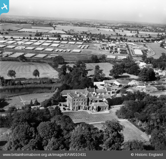
EAW010431 ENGLAND (1947). Scraptoft Hall and Scraptoft Prisoner of War Camp, Scraptoft, from the south, 1947
© Copyright OpenStreetMap contributors and licensed by the OpenStreetMap Foundation. 2026. Cartography is licensed as CC BY-SA.
Nearby Images (8)
EAW010431

EAW010430

EAW010425

EAW010426

EAW010427

EAW010429

EAW010424

EAW010428

Details
| Title | [EAW010431] Scraptoft Hall and Scraptoft Prisoner of War Camp, Scraptoft, from the south, 1947 |
| Reference | EAW010431 |
| Date | 30-August-1947 |
| Link | |
| Place name | SCRAPTOFT |
| Parish | SCRAPTOFT |
| District | |
| Country | ENGLAND |
| Easting / Northing | 464851, 305642 |
| Longitude / Latitude | -1.0414212499502, 52.644286205321 |
| National Grid Reference | SK649056 |
Pins

MB |
Thursday 21st of November 2013 10:24:03 PM |