
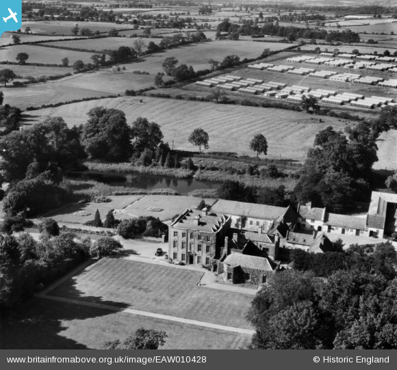
EAW010428 ENGLAND (1947). Scraptoft Hall, Scraptoft, 1947
© Copyright OpenStreetMap contributors and licensed by the OpenStreetMap Foundation. 2026. Cartography is licensed as CC BY-SA.
Nearby Images (8)
EAW010428

EAW010429

EAW010427

EAW010426

EAW010430

EAW010425

EAW010431

EAW010424

Details
| Title | [EAW010428] Scraptoft Hall, Scraptoft, 1947 |
| Reference | EAW010428 |
| Date | 30-August-1947 |
| Link | |
| Place name | SCRAPTOFT |
| Parish | SCRAPTOFT |
| District | |
| Country | ENGLAND |
| Easting / Northing | 464805, 305763 |
| Longitude / Latitude | -1.0420773162941, 52.64537943251 |
| National Grid Reference | SK648058 |
Pins
Be the first to add a comment to this image!