
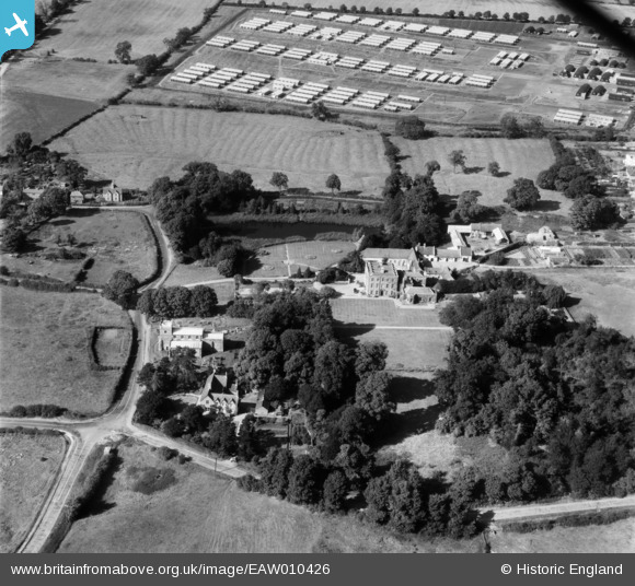
EAW010426 ENGLAND (1947). Scraptoft Hall, Scraptoft, 1947
© Copyright OpenStreetMap contributors and licensed by the OpenStreetMap Foundation. 2026. Cartography is licensed as CC BY-SA.
Nearby Images (8)
EAW010426

EAW010429

EAW010430

EAW010431

EAW010427

EAW010425

EAW010424

EAW010428

Details
| Title | [EAW010426] Scraptoft Hall, Scraptoft, 1947 |
| Reference | EAW010426 |
| Date | 30-August-1947 |
| Link | |
| Place name | SCRAPTOFT |
| Parish | SCRAPTOFT |
| District | |
| Country | ENGLAND |
| Easting / Northing | 464812, 305666 |
| Longitude / Latitude | -1.0419929162798, 52.644506614737 |
| National Grid Reference | SK648057 |

