
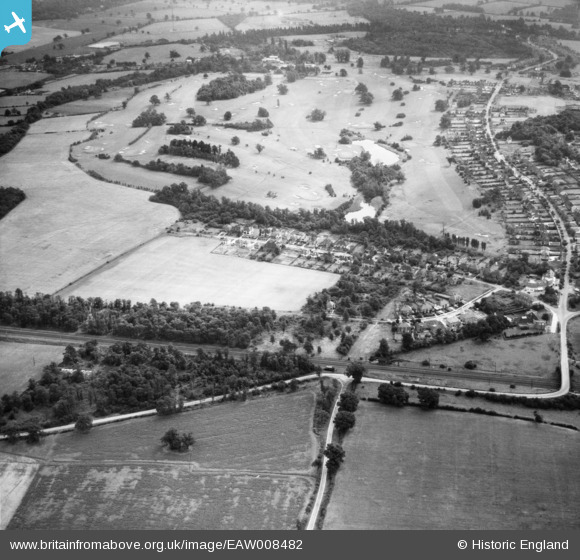
EAW008482 ENGLAND (1947). Bradmore Way and Brookmans Park Golf Course, Brookmans Park, 1947
© Copyright OpenStreetMap contributors and licensed by the OpenStreetMap Foundation. 2025. Cartography is licensed as CC BY-SA.
Nearby Images (3)
EAW008482

EPW021429

EAW008467

Details
| Title | [EAW008482] Bradmore Way and Brookmans Park Golf Course, Brookmans Park, 1947 |
| Reference | EAW008482 |
| Date | 31-July-1947 |
| Link | |
| Place name | BROOKMANS PARK |
| Parish | NORTH MYMMS |
| District | |
| Country | ENGLAND |
| Easting / Northing | 524293, 204417 |
| Longitude / Latitude | -0.20027791434513, 51.724222068093 |
| National Grid Reference | TL243044 |
Pins
Be the first to add a comment to this image!