
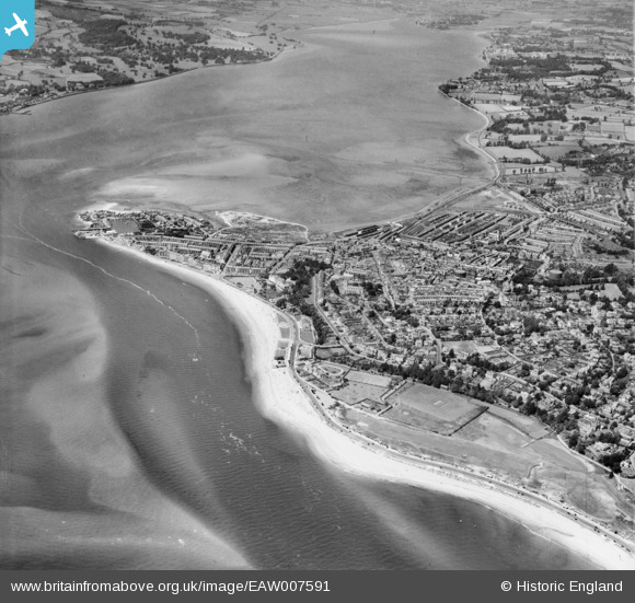
EAW007591 ENGLAND (1947). Cockle Sand, the River Exe and the town, Exmouth, 1947
© Copyright OpenStreetMap contributors and licensed by the OpenStreetMap Foundation. 2026. Cartography is licensed as CC BY-SA.
Nearby Images (11)
EAW007591

EPW023665

EPW023669

EPW033460

EAW031937

EPW039695

EPW023668

EAW031936

EPW023678

EAW051156

EPW039694

Details
| Title | [EAW007591] Cockle Sand, the River Exe and the town, Exmouth, 1947 |
| Reference | EAW007591 |
| Date | 26-June-1947 |
| Link | |
| Place name | EXMOUTH |
| Parish | EXMOUTH |
| District | |
| Country | ENGLAND |
| Easting / Northing | 300121, 80638 |
| Longitude / Latitude | -3.4119451380427, 50.616304240854 |
| National Grid Reference | SY001806 |
Pins

redmist |
Wednesday 11th of January 2023 11:15:19 PM | |
|
redmist |
Wednesday 11th of January 2023 11:11:15 PM | |
|
redmist |
Wednesday 11th of January 2023 11:10:06 PM | |
|
redmist |
Wednesday 11th of January 2023 11:07:48 PM | |
|
redmist |
Wednesday 11th of January 2023 11:05:36 PM | |
|
redmist |
Wednesday 11th of January 2023 11:04:59 PM | |
|
redmist |
Wednesday 11th of January 2023 10:39:32 PM | |
Allen T |
Tuesday 12th of November 2013 03:34:54 PM |