
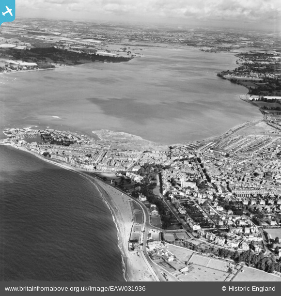
EAW031936 ENGLAND (1950). The River Exe and the town, Exmouth, from the south-east, 1950
© Copyright OpenStreetMap contributors and licensed by the OpenStreetMap Foundation. 2026. Cartography is licensed as CC BY-SA.
Nearby Images (12)
EAW031936

EPW039694

EPW039695

EPW033460

EPW023679

EAW007591

EPW023665

EPW039691

EPW023669

EPW023677

EAW031937

EPW023678

Details
| Title | [EAW031936] The River Exe and the town, Exmouth, from the south-east, 1950 |
| Reference | EAW031936 |
| Date | 17-August-1950 |
| Link | |
| Place name | EXMOUTH |
| Parish | EXMOUTH |
| District | |
| Country | ENGLAND |
| Easting / Northing | 300164, 80452 |
| Longitude / Latitude | -3.4112874104529, 50.614639252756 |
| National Grid Reference | SY002805 |
Pins
Be the first to add a comment to this image!