
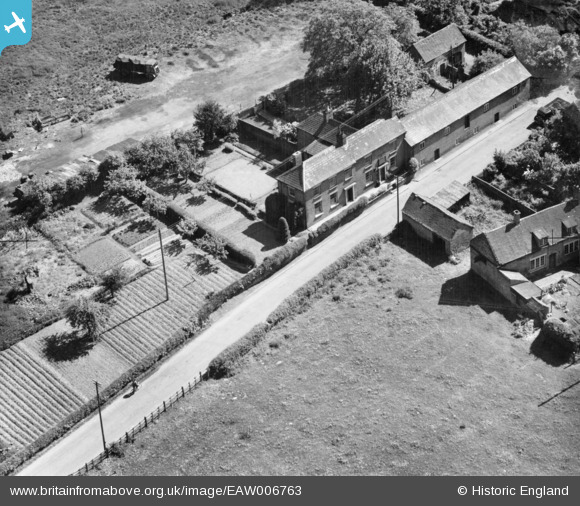
EAW006763 ENGLAND (1947). The Pheasant Inn, Admaston, 1947
© Copyright OpenStreetMap contributors and licensed by the OpenStreetMap Foundation. 2025. Cartography is licensed as CC BY-SA.
Nearby Images (8)
EAW006763

EAW006764

EAW006762

EAW006722

EAW006721

EAW006720

EAW010848

EAW010850

Details
| Title | [EAW006763] The Pheasant Inn, Admaston, 1947 |
| Reference | EAW006763 |
| Date | 28-May-1947 |
| Link | |
| Place name | ADMASTON |
| Parish | WROCKWARDINE |
| District | |
| Country | ENGLAND |
| Easting / Northing | 363519, 313090 |
| Longitude / Latitude | -2.5400881215983, 52.713896132537 |
| National Grid Reference | SJ635131 |
Pins

Andrew Bennett |
Wednesday 4th of June 2014 12:39:42 AM |