
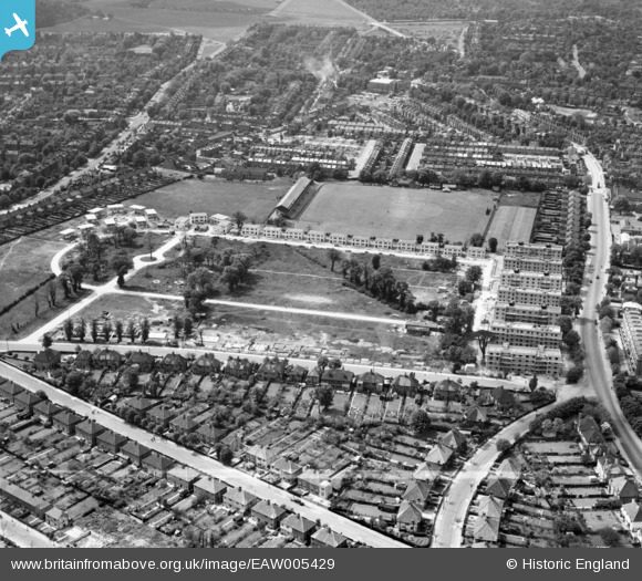
EAW005429 ENGLAND (1947). Rectory Field and prefabricated housing under construction around Rectory Field Crescent, Charlton, 1947. This image was marked by Aerofilms Ltd for photo editing.
© Copyright OpenStreetMap contributors and licensed by the OpenStreetMap Foundation. 2026. Cartography is licensed as CC BY-SA.
Nearby Images (13)
EAW005429

EAW005425

EAW005419

EAW005418

EAW005428

EAW005430

EAW005426

EAW005427

EAW005423

EAW005422

EAW005420

EAW005421

EAW005424

Details
| Title | [EAW005429] Rectory Field and prefabricated housing under construction around Rectory Field Crescent, Charlton, 1947. This image was marked by Aerofilms Ltd for photo editing. |
| Reference | EAW005429 |
| Date | May-1947 |
| Link | |
| Place name | CHARLTON |
| Parish | |
| District | |
| Country | ENGLAND |
| Easting / Northing | 541087, 177373 |
| Longitude / Latitude | 0.031857913100168, 51.477212260794 |
| National Grid Reference | TQ411774 |
Pins

bushwhackers |
Thursday 22nd of February 2018 02:54:57 AM | |
|
bushwhackers |
Thursday 22nd of February 2018 02:54:14 AM | |
|
bushwhackers |
Thursday 22nd of February 2018 02:52:27 AM | |
|
jsmithy1 |
Friday 10th of April 2015 03:57:45 PM |