
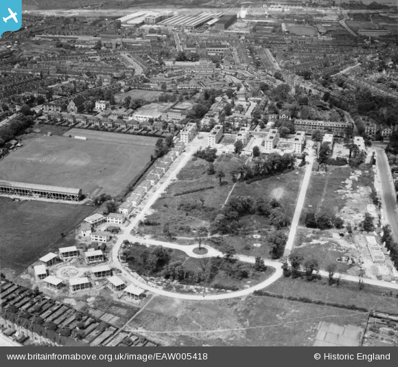
EAW005418 ENGLAND (1947). Prefabricated housing under construction around Rectory Field Crescent, Charlton, 1947
© Copyright OpenStreetMap contributors and licensed by the OpenStreetMap Foundation. 2026. Cartography is licensed as CC BY-SA.
Nearby Images (12)
EAW005418

EAW005425

EAW005430

EAW005429

EAW005428

EAW005427

EAW005423

EAW005426

EAW005422

EAW005420

EAW005419

EAW005421

Details
| Title | [EAW005418] Prefabricated housing under construction around Rectory Field Crescent, Charlton, 1947 |
| Reference | EAW005418 |
| Date | May-1947 |
| Link | |
| Place name | CHARLTON |
| Parish | |
| District | |
| Country | ENGLAND |
| Easting / Northing | 541066, 177445 |
| Longitude / Latitude | 0.03158444437174, 51.4778645543 |
| National Grid Reference | TQ411774 |
Pins

Cherry Orchard |
Friday 10th of June 2016 02:47:59 PM | |
|
Cherry Orchard |
Friday 10th of June 2016 02:47:01 PM | |
|
Cherry Orchard |
Friday 10th of June 2016 02:45:40 PM | |
|
Cherry Orchard |
Friday 10th of June 2016 02:43:01 PM | |
|
gBr |
Monday 19th of October 2015 04:10:24 PM | |
|
gBr |
Monday 19th of October 2015 04:08:38 PM | |
|
pjl |
Sunday 4th of October 2015 07:26:01 PM | |
|
pjl |
Sunday 4th of October 2015 07:22:04 PM |