
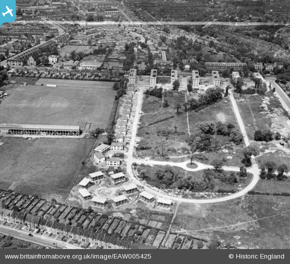
EAW005425 ENGLAND (1947). Prefabricated housing under construction around Rectory Field Crescent, Charlton, 1947. This image was marked by Aerofilms Ltd for photo editing.
© Copyright OpenStreetMap contributors and licensed by the OpenStreetMap Foundation. 2026. Cartography is licensed as CC BY-SA.
Nearby Images (13)
EAW005425

EAW005429

EAW005418

EAW005419

EAW005428

EAW005430

EAW005427

EAW005426

EAW005423

EAW005422

EAW005420

EAW005421

EAW005424

Details
| Title | [EAW005425] Prefabricated housing under construction around Rectory Field Crescent, Charlton, 1947. This image was marked by Aerofilms Ltd for photo editing. |
| Reference | EAW005425 |
| Date | May-1947 |
| Link | |
| Place name | CHARLTON |
| Parish | |
| District | |
| Country | ENGLAND |
| Easting / Northing | 541073, 177390 |
| Longitude / Latitude | 0.031663219224301, 51.477368529826 |
| National Grid Reference | TQ411774 |
Pins
Be the first to add a comment to this image!