
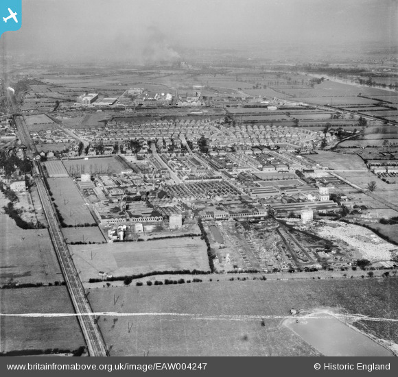
EAW004247 ENGLAND (1947). The British Ericsson Telephone Works, Rylands Estate and environs, Beeston, from the south-west, 1947. This image was marked by Aerofilms Ltd for photo editing.
© Copyright OpenStreetMap contributors and licensed by the OpenStreetMap Foundation. 2026. Cartography is licensed as CC BY-SA.
Nearby Images (32)
EAW004247

EAW006377

EAW005001

EPW052431

EPW053166

EAW005005

EAW006382

EAW004242

EAW005000

EAW006376

EAW005004

EAW004244

EAW006381

EPW053164

EAW004243

EPW053168

EAW004249

EPW053167

EAW004239

EPW053169

EPW052424

EAW004240

EAW006380

EAW006378

EAW004246

EAW004245

EAW006383

EAW005002

EAW005006

EAW012085

EAW006379

EAW004241

Details
| Title | [EAW004247] The British Ericsson Telephone Works, Rylands Estate and environs, Beeston, from the south-west, 1947. This image was marked by Aerofilms Ltd for photo editing. |
| Reference | EAW004247 |
| Date | 9-April-1947 |
| Link | |
| Place name | BEESTON |
| Parish | |
| District | |
| Country | ENGLAND |
| Easting / Northing | 453219, 335728 |
| Longitude / Latitude | -1.2084448028048, 52.916016252813 |
| National Grid Reference | SK532357 |
Pins

Sparky |
Thursday 28th of September 2017 10:39:03 PM | |

Tony |
Saturday 9th of November 2013 09:12:15 AM |