
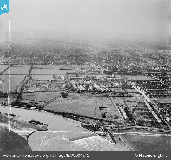
EAW004241 ENGLAND (1947). The British Ericsson Telephone Works and environs, Beeston, from the south-east, 1947. This image was marked by Aerofilms Ltd for photo editing.
© Copyright OpenStreetMap contributors and licensed by the OpenStreetMap Foundation. 2026. Cartography is licensed as CC BY-SA.
Nearby Images (11)
EAW004241

EAW004240

EPW053169

EAW006381

EAW004242

EPW052431

EPW053167

EAW004247

EAW012086

EPW053166

EAW006377

Details
| Title | [EAW004241] The British Ericsson Telephone Works and environs, Beeston, from the south-east, 1947. This image was marked by Aerofilms Ltd for photo editing. |
| Reference | EAW004241 |
| Date | 9-April-1947 |
| Link | |
| Place name | BEESTON |
| Parish | |
| District | |
| Country | ENGLAND |
| Easting / Northing | 453447, 335582 |
| Longitude / Latitude | -1.2050780234536, 52.914681149967 |
| National Grid Reference | SK534356 |
