
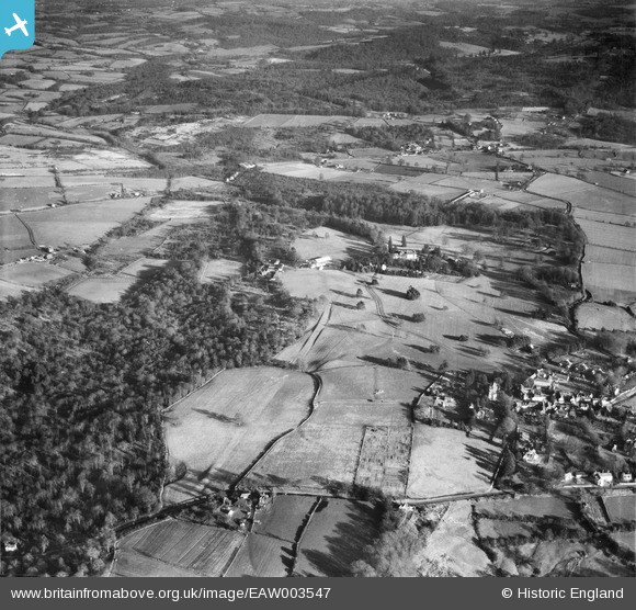
EAW003547 ENGLAND (1947). Fields between the village and Chase Wood, Frant, 1947
© Copyright OpenStreetMap contributors and licensed by the OpenStreetMap Foundation. 2026. Cartography is licensed as CC BY-SA.
Nearby Images (10)
EAW003547

EAW001471

EAW001470

EAW001464

EAW001472

EAW001465

EAW003545

EAW003544

EPW050336

EAW001473

Details
| Title | [EAW003547] Fields between the village and Chase Wood, Frant, 1947 |
| Reference | EAW003547 |
| Date | 16-January-1947 |
| Link | |
| Place name | FRANT |
| Parish | FRANT |
| District | |
| Country | ENGLAND |
| Easting / Northing | 559344, 136019 |
| Longitude / Latitude | 0.27611848646868, 51.100770449363 |
| National Grid Reference | TQ593360 |
Pins
Be the first to add a comment to this image!