
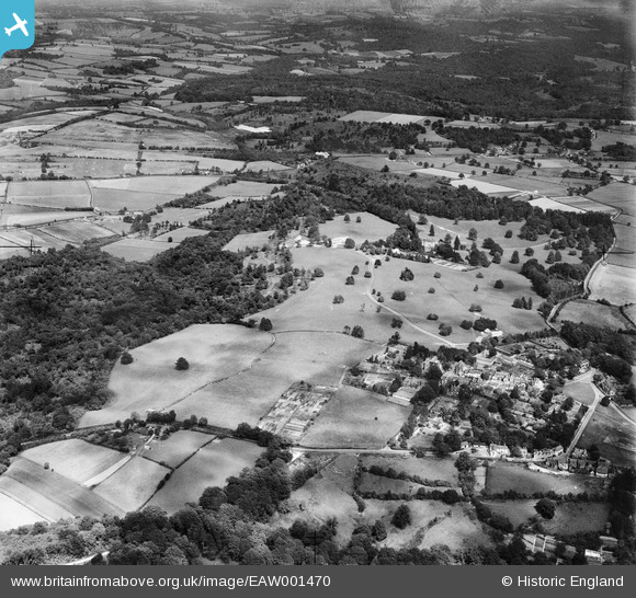
EAW001470 ENGLAND (1946). Fields between the village and Chase Wood, Frant, 1946
© Copyright OpenStreetMap contributors and licensed by the OpenStreetMap Foundation. 2026. Cartography is licensed as CC BY-SA.
Nearby Images (9)
EAW001470

EAW001465

EAW001471

EAW003547

EAW003545

EAW001472

EAW001464

EPW050336

EAW003544

Details
| Title | [EAW001470] Fields between the village and Chase Wood, Frant, 1946 |
| Reference | EAW001470 |
| Date | 3-July-1946 |
| Link | |
| Place name | FRANT |
| Parish | FRANT |
| District | |
| Country | ENGLAND |
| Easting / Northing | 559277, 136005 |
| Longitude / Latitude | 0.27515606812948, 51.100663264708 |
| National Grid Reference | TQ593360 |
Pins

Sparky |
Saturday 23rd of September 2017 10:05:32 AM |