
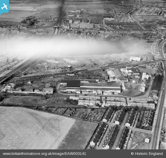
EAW003141 ENGLAND (1946). The Birtley Iron Co Ltd Works, Birtley, 1946. This image has been affected by flare.
© Copyright OpenStreetMap contributors and licensed by the OpenStreetMap Foundation. 2026. Cartography is licensed as CC BY-SA.
Nearby Images (14)
EAW003141

EAW003138

EAW003143

EAW003145

EAW003148

EAW003136

EAW003146

EAW003139

EAW003142

EAW003144

EAW003149

EAW003140

EAW003147

EAW003137

Details
| Title | [EAW003141] The Birtley Iron Co Ltd Works, Birtley, 1946. This image has been affected by flare. |
| Reference | EAW003141 |
| Date | 23-October-1946 |
| Link | |
| Place name | BIRTLEY |
| Parish | |
| District | |
| Country | ENGLAND |
| Easting / Northing | 427045, 555169 |
| Longitude / Latitude | -1.5783200110167, 54.890444549245 |
| National Grid Reference | NZ270552 |
Pins

Matt Aldred edob.mattaldred.com |
Monday 8th of March 2021 06:37:39 PM |