
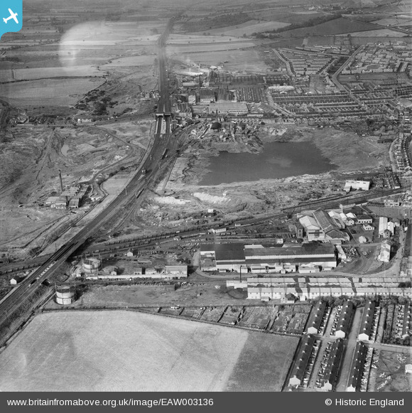
EAW003136 ENGLAND (1946). The Birtley Iron Co Ltd Works and the surrounding industrial area, Birtley, 1946
© Copyright OpenStreetMap contributors and licensed by the OpenStreetMap Foundation. 2026. Cartography is licensed as CC BY-SA.
Nearby Images (11)
EAW003136

EAW003138

EAW003141

EAW003148

EAW003143

EAW003145

EAW003142

EAW003146

EAW003137

EAW003139

EAW003140

Details
| Title | [EAW003136] The Birtley Iron Co Ltd Works and the surrounding industrial area, Birtley, 1946 |
| Reference | EAW003136 |
| Date | 23-October-1946 |
| Link | |
| Place name | BIRTLEY |
| Parish | |
| District | |
| Country | ENGLAND |
| Easting / Northing | 426950, 555248 |
| Longitude / Latitude | -1.5797937967905, 54.891159664593 |
| National Grid Reference | NZ270552 |
Pins

Matt Aldred edob.mattaldred.com |
Monday 8th of March 2021 06:35:44 PM | |

Ebo77 |
Thursday 3rd of October 2019 06:49:33 PM | |

Sparky |
Friday 15th of September 2017 08:56:00 AM | |
|
totoro |
Monday 28th of July 2014 07:38:23 PM | |
|
totoro |
Monday 28th of July 2014 07:37:36 PM |