
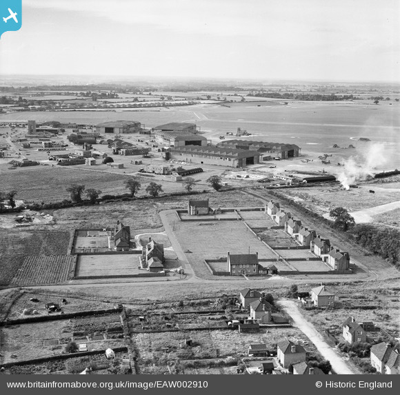
EAW002910 ENGLAND (1946). Housing off Dowding Road and RAF Horsham St Faith, Norwich, from the east, 1946
© Copyright OpenStreetMap contributors and licensed by the OpenStreetMap Foundation. 2026. Cartography is licensed as CC BY-SA.
Nearby Images (3)
EAW002910

EAW002906

EAW001956

Details
| Title | [EAW002910] Housing off Dowding Road and RAF Horsham St Faith, Norwich, from the east, 1946 |
| Reference | EAW002910 |
| Date | 1-October-1946 |
| Link | |
| Place name | NORWICH |
| Parish | |
| District | |
| Country | ENGLAND |
| Easting / Northing | 622779, 312844 |
| Longitude / Latitude | 1.295105418021, 52.667097220647 |
| National Grid Reference | TG228128 |
Pins

Matt Aldred edob.mattaldred.com |
Tuesday 24th of November 2020 10:11:59 PM | |
|
Matt Aldred edob.mattaldred.com |
Tuesday 24th of November 2020 10:11:47 PM | |
|
Matt Aldred edob.mattaldred.com |
Tuesday 24th of November 2020 10:11:36 PM | |
|
Matt Aldred edob.mattaldred.com |
Tuesday 24th of November 2020 10:11:13 PM | |
|
Matt Aldred edob.mattaldred.com |
Tuesday 24th of November 2020 10:10:21 PM | |

Mark P |
Saturday 4th of July 2020 12:46:47 AM | |
|
Mark P |
Saturday 4th of July 2020 12:45:39 AM | |
|
sum0 |
Wednesday 15th of April 2020 09:32:11 PM | |
|
cptpies |
Wednesday 30th of August 2017 01:51:56 PM | |
|
cptpies |
Wednesday 30th of August 2017 01:51:28 PM | |
|
cptpies |
Monday 16th of December 2013 03:49:42 PM |
User Comment Contributions

RAF Horsham St Faith and pillbox. |
cptpies |
Thursday 19th of December 2013 02:12:50 PM |