
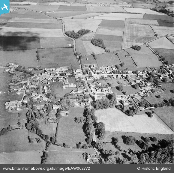
EAW002772 ENGLAND (1946). The village, Empingham, 1946
© Copyright OpenStreetMap contributors and licensed by the OpenStreetMap Foundation. 2026. Cartography is licensed as CC BY-SA.
Nearby Images (5)
EAW002772

EAW002770

EAW002771

EAW002769

EAW002774

Details
| Title | [EAW002772] The village, Empingham, 1946 |
| Reference | EAW002772 |
| Date | 11-September-1946 |
| Link | |
| Place name | EMPINGHAM |
| Parish | EMPINGHAM |
| District | |
| Country | ENGLAND |
| Easting / Northing | 494992, 308606 |
| Longitude / Latitude | -0.59516833692491, 52.66648611071 |
| National Grid Reference | SK950086 |
Pins

totoro |
Saturday 5th of April 2014 09:56:32 PM | |
|
totoro |
Saturday 5th of April 2014 09:52:41 PM | |
|
totoro |
Saturday 5th of April 2014 09:49:09 PM | |
|
totoro |
Saturday 5th of April 2014 09:48:39 PM | |
|
totoro |
Saturday 5th of April 2014 09:42:58 PM | |
|
totoro |
Saturday 5th of April 2014 09:42:33 PM | |
|
totoro |
Saturday 5th of April 2014 09:38:28 PM | |
|
totoro |
Saturday 5th of April 2014 09:31:52 PM | |
|
totoro |
Saturday 5th of April 2014 09:29:30 PM | |
|
totoro |
Saturday 5th of April 2014 09:29:14 PM | |
|
totoro |
Saturday 5th of April 2014 09:26:16 PM | |
|
totoro |
Saturday 5th of April 2014 09:23:02 PM |