
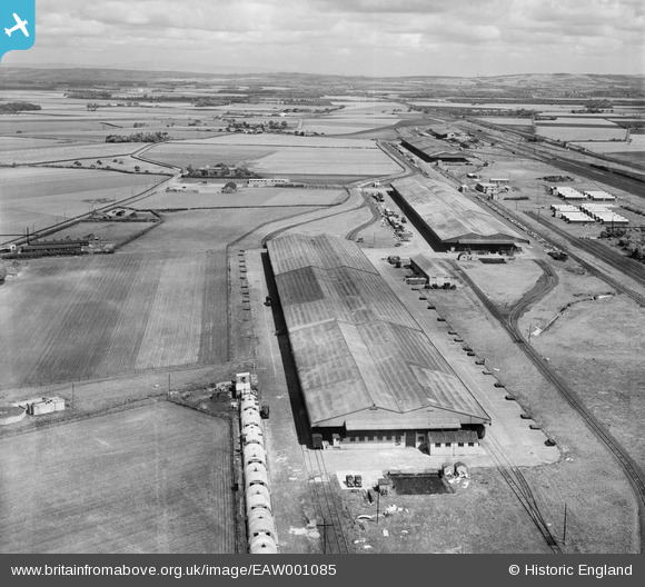
EAW001085 ENGLAND (1946). An unidentified depot located between Stopgate Lane and the railway line, Bickerstaffe, from the south-west, 1946
© Copyright OpenStreetMap contributors and licensed by the OpenStreetMap Foundation. 2026. Cartography is licensed as CC BY-SA.
Nearby Images (4)
EAW001085

EAW001079

EAW001083

EAW001078

Details
| Title | [EAW001085] An unidentified depot located between Stopgate Lane and the railway line, Bickerstaffe, from the south-west, 1946 |
| Reference | EAW001085 |
| Date | 3-June-1946 |
| Link | |
| Place name | BICKERSTAFFE |
| Parish | SIMONSWOOD |
| District | |
| Country | ENGLAND |
| Easting / Northing | 342592, 400638 |
| Longitude / Latitude | -2.8655317377945, 53.499053791987 |
| National Grid Reference | SD426006 |
Pins

austin |
Saturday 1st of July 2023 02:56:03 PM | |

Sparky |
Sunday 24th of September 2017 06:03:31 PM | |
|
Sparky |
Sunday 24th of September 2017 05:58:16 PM | |
|
Dave |
Wednesday 23rd of April 2014 12:21:19 PM |